


SityTrail hiking trail GPS
Opis aplikacije SityTrail hiking trail GPS
Идите и откријте све путеве широм света
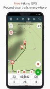
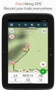
• Снимите своје стазе док снимате ХД и гео-таговане слике ваших авантура.
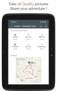
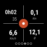
• Пређени пут, км-напор, просечна брзина, потрошене калорије итд.
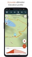
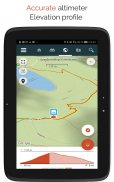
• Тачан висиномер, израчунавање висинских разлика и профил надморске висине који приказује вашу тренутну локацију.
• Аларм када скренете са путање коју пратите. Нема више потребе за повлачењем!
• Аутоматско покретање тачака интересовања са претварањем текста у говор.
• Направите бесплатан налог и сви ваши подаци ће бити доступни свуда на сваком уређају.
• Лако креирање стаза и занимљивих места са наше веб странице.
• Помоћу нашег онлајн уређивача, креирајте сопствене стазе користећи веб претраживач на свом ПЦ/Мац-у, а затим им приступите директно са паметног телефона да бисте их искусили на земљи.
• Сортирајте и класификујте своје стазе и интересантне тачке у сопствене листе.
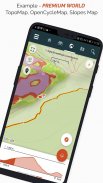
Идите даље и постаните ПРЕМИУМ корисник!
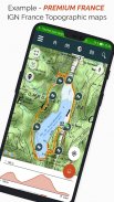
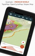
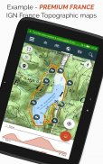
• Преузмите топографске карте света за употребу ван мреже.
• Откријте ГР пешачке стазе, европске пешачке руте, руте Сантиаго де Цомпостела за ходочаснике итд.
• Додајте топографске карте по вашем избору, из ИГН Француска, ИГН / НГИ Белгија, ИГН Шпанија, Свисстопо, Аустрија, САД (УСГС топографско мапирање), Канада (Топорама).
• Такође можете открити све бициклистичке мреже: Греенваи мрежу у Француској, Равел у Белгији, европске бициклистичке руте, мреже чворова у Фландрији и Холандији.
• А зими откријте све ски стазе са њиховим именима.
• Приступите јавном каталогу стаза чланова и заједница СитиТраил-а.
• Напредне функције праћења и вођења са прорачуном преостале удаљености и времена и гласовним упутствима на раскрсницама.
• Идите даље и трансформишите своје омиљене стазе у праве мултимедијалне водиче са текстом, фотографијама, видео везама и поделите их са СитиТраил заједницом.
• Креирајте сопствене заједнице планинара и управљајте својим члановима и изворима вести.
• Креирајте стазе са нашим напредним функцијама за уређивање стаза преко наше веб странице.
• Штампајте стазе у ПДФ формату са КР кодовима. (А4, А3).
• Приступите чланцима Википедије са географским ознакама из нашег СитиТрип модула.
Снимите траг на Веар ОС сату
Можете да снимите траг на Веар ОС сату у самосталном режиму (није повезан са Андроид паметним телефоном) или у упареном режиму (повезан са Андроид паметним телефоном).
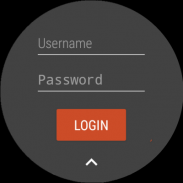
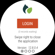
Апликација такође омогућава пријављивање на ваш постојећи СитиТраил налог (са екрана који је највише лево) када се сат користи у самосталном режиму.
Важне информације
• За неке функције је потребна интернет веза.
• Продужена употреба ГПС-а може смањити нивое батерије.
SityTrail hiking trail GPS - Verzija 12.15.1.55
(17-02-2025)SityTrail hiking trail GPS - Informacije o APK datoteci
Verzija APK datoteke: 12.15.1.55Paket: com.geolivesPoslednja verzija aplikacije SityTrail hiking trail GPS
Druge verzije


Aplikacije u istoj kategoriji

Možda će vam se takođe dopasti i...


